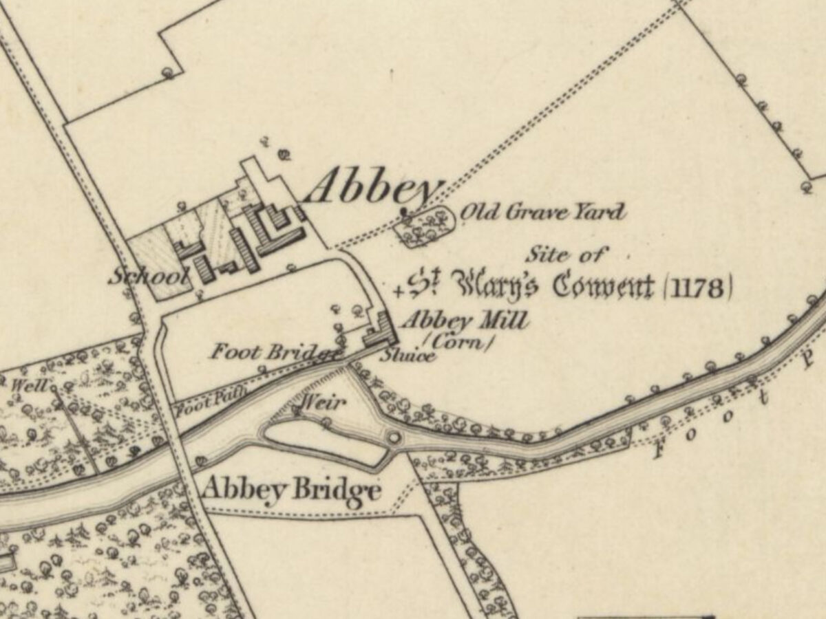
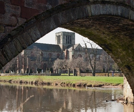
This trail leads to the site of the Abbey of St Mary, once one of the richest medieval convents in the Lothians. On the way, it takes in features linked to the Abbey.
Allow 1 ½ to 2 hours for the round trip. The path is good as far as the site but can be muddy.
Start at the John Gray Centre. There are toilets here and in Neilson Park Road close by. There are cafes in the vicinity.
John Gray Centre to Nungate Bridge, 10 minutes.
Follow the High Street to Church Street and cross the Nungate Bridge.
Although damaged, the bridge survived the Siege of Haddington (1548-49). It carried the Nuns’ Road (the Nungate) to the Abbey. The Nuns’ property begins once you cross. Note the hangman’s hook under the first arch.
Nungate Bridge to St Martin’s, 10 minutes.
Pass the yellow building in front by a narrow lane to the left, emerging at Tannery Lane. From the end of the lane, the large sandstone building you see ahead is Bermaline Maltings, on the site of Gimmers Mills, former property of the Abbey. Turn right and follow St Martin’s Gate round to St Martin’s Church.
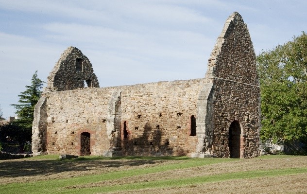
Dedicated to St Martin of Tours, the church is almost as old as the Abbey. It was given to the nuns around 1170. Of the 26 churches controlled by the convent, this was one of the most important. The lines of square holes may relate to scaffolding from its construction.
St Martin’s to Abbey Bridge and the Abbey site, 30 minutes.
Head towards the sports ground and cross the Tyne by the pedestrian bridge. Turn right past the playpark and follow the riverside path.
The land on both sides of the Tyne was Abbey property. In about 15 minutes, you will see this water feature.
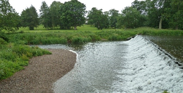
On the bank opposite, the nuns owned a mill for fulling cloth (a wauk mill). After the Abbey was demolished, ca 1560, two corn mills were built here, possibly from the masonry. In turn the mills were replaced by one of the earliest and largest cloth-making concerns in Scotland. Hundreds worked here. Following its collapse, the land was bought by Sir Francis Charteris in 1726 and became his estate of Amisfield. The cascade was built as an ornamental feature. An information panel further along has more on Amisfield.
To the left of the cascade, the large mound is an artillery platform built when French and Scottish troops were stationed at the Abbey during the Siege (1548-49).
Follow the path sign-posted East Linton through the arch of Abbey Bridge.
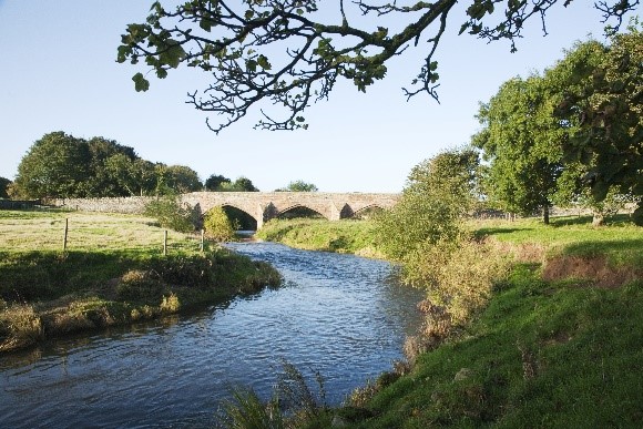
The road which crosses here linked the Abbey to its lands on the opposite bank and to Haddington. To the north it led to the Great North Road, later the A1.
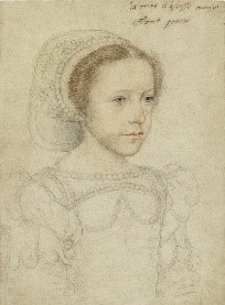
Continue past the ruined Abbey Mill. The lade drove the mill and provided drainage for the Abbey. The ruins are dangerous. Stick to the path here and at the site. At the next gate is the information panel on the Abbey. Here the future of the young Mary Queen of Scots was determined. Scan the QR code here or on this guide for more.
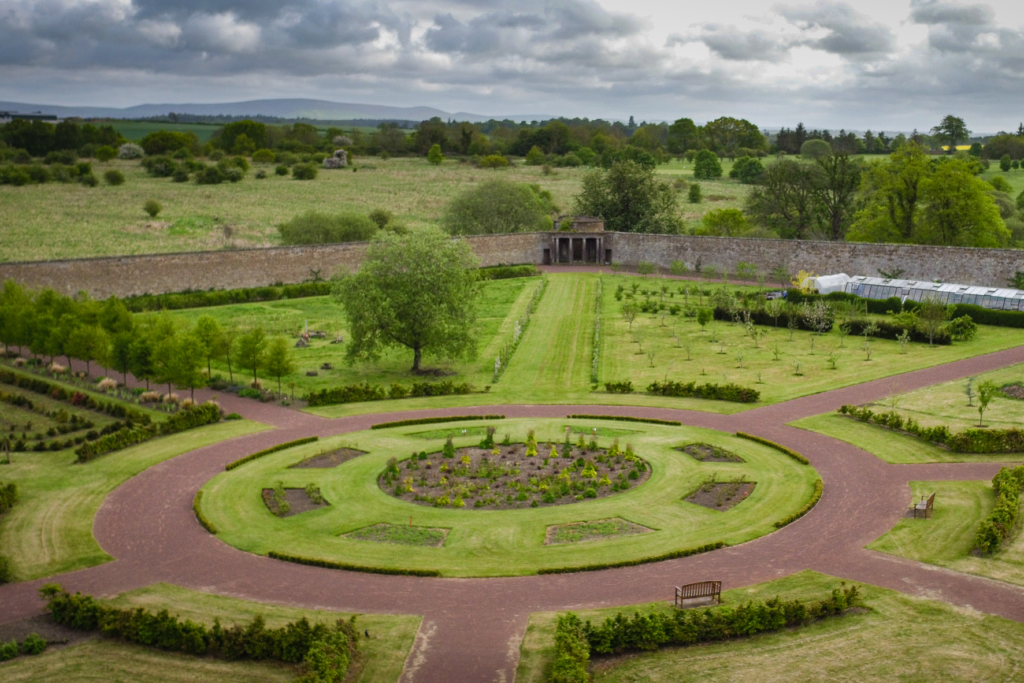
Retrace your steps to return to Haddington or cross Abbey Bridge (with care) to visit Amisfield walled garden a short distance on the right.
From the garden follow the path through the golf course back to the town.
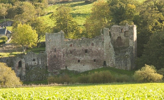
For a longer walk, continue on the river path to Hailes Castle. The path is more challenging and stout footwear is advised. (Allow at least 1hr 15 minutes.) Cross by the footbridge to visit the castle (unstaffed). The castle belonged to the Earls of Bothwell, the Hepburn family, who controlled the Abbey in its later years and benefited greatly from its wealth.

© Haddington’s History Society, 2022.
.
You must be logged in to post a comment.