By Jean McKinnon 12th Dec 2024
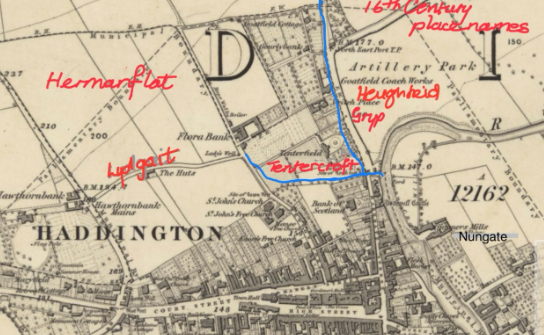
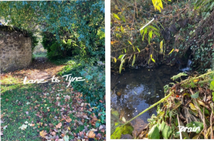
From her long, detailed and continuing study of records and maps pertaining to the ownership of buildings and burgage plots of 16th Century Haddington, Jean selected a fascinating short talk on the tributaries passing through the town to join the River Tyne. One such flowed from Harperdean and is described as Harperdean Burn today. It joined up with another rising from a spring, Ladywell (Lady’s Well), which followed the line of Victoria Park running north of the town wall through Tenterfield (Tentercroft in 16th C). These streams are probably both still flowing today, but now underground in culverts. In fact, there is little stream in the ditch parallel to the road near the entrance to Henderson’s, which emerges from under the A199 through a low stone arch and returns underground just before Herdmanflatt. This is likely to be Harperdean Burn. In addition, the steady water flow from a culvert into the Tyne at the foot of an overgrown lane just before the Artillery Park junction and opposite Tenterfield Drive (photograph) offers further evidence.
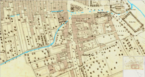
19th Century map of Haddington
The following transcript from contemporary documents confirms the position and gives the 16th century name for the Lady’s Well stream.
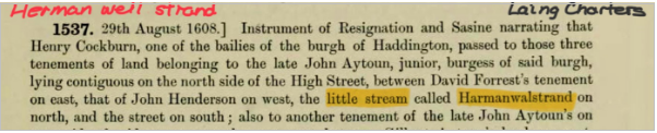
On this 19th C map, red marks the position of the buildings and an eastern boundary of long burgage plots. Note that the stream is written as Harmanwalstrand in the transcript which may be a corruption of Herman Well Strand. It seems likely that Herman Well is another name for Lady’s Well, not surprising in that Hermanflat (now Herdmanflatt) names the land just to the northwest of the well.
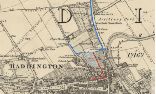
Two further streams are referenced in 16th C Haddington: the Loth Burn and the Mylds Burn, shown superimposed on the 19th C map below.
The Mylds Burn once followed a course which is now The Butts footpath, while the Loth Burn followed a course south of the High Street. From a confluence near St Ann’s Place, the combined waters flowed along the line of Church Street to The Sands, continuing to the Tyne between Elm House and the old Bowling Green. Again, both streams perhaps still flow, but in culverts. Perhaps the rush of water easily heard through a drain cover in Church Street are the combined waters heading for the Tyne.
A final comment relates to Lady’s Well. It was in use as a spring of good fresh water during the 19th C. Its location was near the junction of Lydgait with Florabank Road, but it has been lost under housing and road development.
You must be logged in to post a comment.